Fast forward to September. We recently discovered 2 new unauthorized charges on the same bank debit card and this time, we immediately got it stopped. Bad news (besides the fraud)? We're now down an ATM card. Good news? We carry debit cards for 2 separate accounts so we still have the ability to withdraw money. Except, when one doesn't work, we don't have a backup debit card. We've come across this several times on our journey already where one works but the other doesn't...so, we were worried about getting the replacement card quickly.

Showing posts with label Planning. Show all posts
Showing posts with label Planning. Show all posts
Wednesday, September 19, 2012
A Headache to Deal With Bank Card Fraud While Traveling
We reported back in June that there may have been unauthorized use of one of our bank debit cards we use to withdraw money only (we never use it as a credit card). After discussing with the claims department, the charges were reversed and the incident never occurred again so we thought it might have been just an honest mistake of wrong account number or something. (During the same time, we did have a confirmed fraudulent charge on one of our credit cards, which we immediately canceled. Fortunately, it wasn't one of the cards we are traveling with).

What a State Department's Security Warning Looks Like
We aren't traveling in a bubble. We keep up on the news, and have been just as concerned as everyone else about the recent attacks on United States embassies and angry extremists capable of harming a lot of innocent people.
We are trying to be as safe as we can, being aware of our environment and such; but we have no intention of changing our itinerary unless there is something more compelling, such as news that the State Department is evacuating staff from a country, for example.
Having said that, one thing we did do was to register our travels through the State Department's Smart Traveler Enrollment Program (STEP). By enrolling, we receive latest security updates and makes it easier for the nearest US embassy or consulate to contact us in an emergency. We're also provided the embassy/consulate address and contact information, including an emergency contact.
Monday, August 6, 2012
How-To (Or How-Not-To) Refill Prescription Meds While Traveling
We had a solid Plan A. Before we left on our trip, we had our 90-day supply of prescription meds, plus we even received from our discount prescription provider, Medco, an additional 90-day supply through their "travel" program. Usually, they would not release more than a 90-day supply; however, they will for travel purposes. Instead of carrying around a 6-month supply of meds (very bulky and takes up precious backpack space!), we decided to have someone mail the next 90-day supply to us while we were in Argentina for 3-weeks. Genius, right? Well, not so genius when...
Friday, July 20, 2012
Tuesday, July 10, 2012
Importance of Confirming Flights
In the States we don't usually bother to call and confirm flights, as we typically receive email updates and such. Not so, on this trip!
Every flight we've taken so far has had an itinerary change.
The Miami-Quito flight changed several times, ending up with an extra night in Miami.
Trying to confirm our Lima to Cuzco flight was complicated because we couldn't reach them at their toll-free number until we used our international phone plan to call their local office. But, good thing we persisted because the flight times had changed.
For our upcoming Lima to Buenos Aires flight on LAN Airlines, we tried to verify our flights online but it wasn't recognizing any of the confirmation or reservation codes we received from AirTreks. AirTreks gave us additional codes but those didn't work either. When we got back to Cuzco, we decided to just go to a LAN Airlines office in person. This is when we discovered that our flight times dramatically changed. Our original 11:45 am flight no longer existed. The only alternative was a 7:10 am flight now. Had we shown up at the airport for the 11:45 am flight, we would've had to have an unexpected overnight stay in Lima or Santiago, Chile.
So, we have learned that flight confirmation is a very important part of our travel plans.
Every flight we've taken so far has had an itinerary change.
The Miami-Quito flight changed several times, ending up with an extra night in Miami.
Trying to confirm our Lima to Cuzco flight was complicated because we couldn't reach them at their toll-free number until we used our international phone plan to call their local office. But, good thing we persisted because the flight times had changed.
For our upcoming Lima to Buenos Aires flight on LAN Airlines, we tried to verify our flights online but it wasn't recognizing any of the confirmation or reservation codes we received from AirTreks. AirTreks gave us additional codes but those didn't work either. When we got back to Cuzco, we decided to just go to a LAN Airlines office in person. This is when we discovered that our flight times dramatically changed. Our original 11:45 am flight no longer existed. The only alternative was a 7:10 am flight now. Had we shown up at the airport for the 11:45 am flight, we would've had to have an unexpected overnight stay in Lima or Santiago, Chile.
So, we have learned that flight confirmation is a very important part of our travel plans.
Day 68: The Magic and Mystery of Machu Picchu

1. Machu Picchu is actually the name of one of the mountains surrounding the ruins. It means "old mountain."
2. Incas were experts at agriculture, creating terraces that acted as microclimates whereby corn, potatoes, quinoa, and other crops could be tested and bred to maximize the growing capacity. They needed reliable growing methods of foods to sustain the large Incan population that lived in many differing climates.
3. Incans hauled fertile soil and white granite rocks from the valley 1000 feet below, up to Machu Picchu.
3. Machu Picchu may have been a place for military, spiritual, and political leaders from Cusco (the capital) to meet and discuss affairs of state in a secluded and secure place.
4. Hiram Bingham was NOT the first person to discover Machu Picchu.
5. 3 people explored it in 1901; an engineer spotted it from a distance; 2 englishmen climbed up to the ruins in 1906; and a German businessman may have discovered and plundered the site in 1867.
6. Locals knew about Machu Picchu. 2 native farmers were using the terraces for farming when Bingham came upon them during his "discovery."
7. No one really knows why Machu Picchu was abandoned for sure, but in the 1500s, officials and dignitaries decided to leave in fear of execution depending upon who won the Incan civil war, which corresponded with the fatal diseases brought over by the Spaniards, which corresponded with the Spanish conquest.
8. Incans were NOT the first people to habitate Machu Picchu. There is evidence that the first constructions date back 4000 years, or longer, by the Uran Pacha and Hanan Pacha cultures.
9. The precision of masonry, square and refined stones with smooth surfaces are most likely Uran Pacha construction; while the roughly assembled, smaller size, quarried rocks, and field stones are Incan construction.
10. We were surprised at how accessible the ruins were. Except for just a few roped off areas, the entire place and mountains can be accessed. Very cool...and dangerous. Many stairways and paths lead to nowhere but off a cliff. The uneven stone walkways and stairs can be slippery. We can imagine people slipping and falling to their deaths, but who knows - there are really no published reports on deaths in Machu Picchu that we could find.


The usual route is for people to fly into Lima, spend a night, fly to Cuzco, spend a night, take a train from Poroy (20 min. from Cuzco) to Machu Picchu Pueblo. Some spend the night in the town, then go to the ruins the next day. Some try to travel to Machu Picchu, explore the ruins, and leave...all on the same day. We thought our plan of spending 3 days in Cuzco to acclimate to the altitude helped us with the 5 hours of hiking around Machu Picchu without any problems, although we understand not every has that kind of time.

Many go to Machu Picchu before dawn to view the sunrise, so the buses start running around 5:30 am. Tickets can be purchased in advance or day of. Plenty of buses run all day long so we had no problems getting a seat, quickly. Or, to save yourself $17, you can hike (more like climb) the 1000 feet vertical face of the mountain that takes approximately 1.5 to 2 hours.

For $4.99, we actually downloaded a book to our Kindle, published in 2012 titled, "Machu Picchu: Virtual Guide and Secrets Revealed" by Brien Foerster. Not only did this book give us a history of the Incas, it gave us a nice self-guided walking tour of the sites, as well as recommended treks outside of the ruins, such as the hikes to the Sun Gate and Inca Bridge. With this book, we learned enough about the sites to make it interesting.
And now, the part you were waiting for. Here are just a few of our photos we took.
[Below: map of Machu Picchu.]

[Below: we entered onto the terraces from the buildings on the far side to a full view of the terraces and ruins. The Incans mastered the construction of terraces, which can be found on mountainsides all over their former empire.]


[Below: llamas and alpacas grazing on the terraces - a natural lawn mower, and friendly, too!]


[Below: our first main goal was to hike up many many stairs to the former guardhouse at the top of these terraces for one of the best views of the entire place.]

[Below: view of guardhouse. Also, where the Inca Trail ends.]

[Below: Mike walking the last 20 meters or so, of the Inca Trail.]

[Below: called a funerary rock, possibly a place for meditation, carved out of solid granite.]

[Below: postcard perfect! View our YouTube video of panorama here.]

[Below: a panoramic view.]

[Below: traffic jam of Japanese tour group trying to get through the main gate used by the Incas to go into town.]

[Below: Mike said his new house would be a lot better if Akiko brought over a bottle of wine as a housewarming gift.]

[Below: Akiko claimed this house for herself, but the doorway is rather small. Incans were short statured and thin.]

[Below: a series of windows.]

[Below: Temple of the Three Windows.]

[Below: Akiko hugging the stones of the Principal Temple in the Sacred Plaza.]

[Below: Intihuatana or "Hitching Post of the Sun". As an astronomical observatory,
at midday on March 21st and September 21st (the equinoxes),the sun stands almost directly above the pillar, creating no shadow at all. At this precise moment the sun "sits with all his might upon the pillar" and is for a moment "tied" to the rock. Also, each of the 4 corners points directly towards the 4 regions of the Inca Empire, as well as the 4 mountains surrounding this plateau. The mystery is that each of the peaks of the 4 mountains also has an Intihuatana, speculating that this was more than just a device to identify the equinox. It is said that the northern corner (where everyone has their hands up), has a magnetic pull.]

[Below: Funny sign. Really? The path goes off the cliff? Thanks for the "sturdy" handrail, since literally, it is a 1000 foot drop on the other side.]

[Below: Temple of the Condor. Rock shaped into a condor, and Mike walking through the narrow temple fissure.]


[Below: carefully constructed aqueduct system through town so they had constant running water. Quite modern, don't you think?]

[Below: Temple of the Sun and the Royal Tomb below the temple.]


[Below: last views on our exit out. Terraces in the background. View of the eastern side of Machu Picchu.]


[Below: we also hiked to the Inca Bridge. It's not just a bridge! You'll see how fascinating this is.]

[Below: the trail, although relatively flat, was only about 2 feet wide and no barrier in parts to prevent you from plummeting down. Here, some pics close to the edge.]


[Below: there's the Inca Bridge in the background! On the side of a granite wall, the Incas built a stone foundation and pillars, then used wooden boards as a draw bridge to prevent people from accessing Machu Picchu. This was only 1 of 2 entry points into this sacred place. The last part of the trail gets even narrower and a rope is provided to hang onto.]


View all photos at Peru - Machu Picchu Photo Album.
Well, that's all folks! All this exploring took about 5-hours, and there were so many more hikes we could've done, but we will leave that for the next time. :)
Saturday, June 23, 2012
Day 51: Bus Trip from Cuenca, Ecuador to Máncora, Peru
 The 360 km Ecuador to Peru bus trip was the ride we were dreading because we had read about all the difficulties experienced along this route. The typical stories included getting on a bus that only took them to the nearest border town, but had to find a taxi to actually take them to the Ecuadorian immigration office (which is 3 km away from the actual border), then had to find a taxi or walk across the border to the Peruvian immigration office (which is also another 3 km away from the actual border in the town of Zarumilla), then had to locate another bus that continued down into Peru. Also, some have reported getting a bus from Ecuador that takes them across the Peruvian border, but did not stop at the Ecuadorian immigration office to get stamped out, so they had to return to Ecuador. Not to mention the multiple scam artists who prey on tourists trying to do this border crossing on their own. It all sounded very complicated so we were not looking forward to this experience.
 The most important point for us to recognize was that no matter how much research and planning we did, each person experienced a different twist or turn. The best information we found was through the Cuenca expat website called www.GoGo-Gringo.com. We took their recommendations, but as imagined, our experience did not exactly match what they went through. Here is the documentation of OUR Cuenca to Máncora trip in hopes that this will add to the body of information available to alleviate some uncertainty for the next soul thinking about making this trip.
Our plan was to leave Cuenca, Ecuador on Wednesday, June 20th, 2012.

Monday, June 18th: We took a taxi to the main Terminal Terrestre in Cuenca to purchase tickets for our anticipated bus ride to Máncora, Peru. GoGo-Gringo recommended buying tickets through the Pullman Sucre bus line all the way to Máncora, because this bus was suppose to take us directly to the Ecuadorian immigration; then transfer us to the CIFA bus line at the border town of Huaquillas, Ecuador; which will then take us through the Peruvian immigration and onto our destination. We saw on the bus schedule that there was a 9 am bus to Máncora that GoGo-Gringo also took, but when we talked to the attendant at the window, we only had 2 choices: 7:15 am or 9 pm bus. They should really change the posted bus schedule if it's not accurate...but, whatever. Yet another reason to go a day or two in advance to purchase tickets. We went with the 7:15 am departure because we certainly did not want to risk the dangers of traveling overnight. We were given 2 separate tickets. One from Cuenca to Huaquillas at $7/pp and another from Huaquillas to Máncora at $8/pp.


Wednesday, June 20th, 0700: To get from the inside of the terminal to the outside where the buses are lined up, it costs 10 cents to go through the turnstile. Be warned, once you go through the turnstile, there really is no way to get back into the terminal which has the restrooms, food, etc.
0715: We located the one and only Pullman Sucre bus among about a dozen buses idling, but we started getting worried when the bus door was still closed, there was no bus driver or bus attendant that usually accompanies the ride, and no overt signage that says this bus was headed towards Huaquillas. Miraculously, the bus personnel and passengers showed up at 0720, we all got onboard and the bus pulled away a couple of minutes later. We had assigned seats on this bus.

0740: We meandered through Cuenca, stopping a million times to pick up passengers until the bus was full. We were finally getting used to this process! We picked up a bunch of people at Centro Comercial El Arenal - a HUGE indoor and outdoor central market of Cuenca. It looked like an excellent place for sightseeing...next time we're in town.
0800: We were finally headed out of Cuenca, southwest bound towards Santa Rosa, Machala, and Huaquillas.
0930: This ride was rough at times. Literally, dirt roads through the steep mountains! We hypothesized that the bus attendant started playing a video on board (Rambo, First Blood at that!) so that we would be distracted from the sheer vertical drops along our route.
1000: As we started leaving the Andes behind, the landscape changed dramatically to dry, arrid, rocky, brown mountains with a river running through it. It was very beautiful.

1045: We pulled into the very dusty, depressed town of Machala at an actual Pullman Sucre bus station....and to think we were at one point, thinking about spending the night here to break up the 10-hour bus ride.
1100: We started seeing HUGE banana groves to the horizon on both sides. Ecuador is one of the biggest banana exporters in the world, and we witnessed where they all come from. Wow!

1130: We briefly stopped in the city of Santa Rosa. Also, very dusty and run-down.
1200: ...then, the city of Arenillas. Ditto on the conditions of this town...

1230: We finally made it to the Huaquillas CIFA bus terminal where we were...unexpectedly...dropped off. It was unexpected because in all our research, we were suppose to pass through the Ecuadorian immigration office BEFORE we got dropped off in Huaquillas! Arrghhh. Of course, trying to have this conversation with the bus attendant and CIFA office lady was fruitless. Great. We had no idea where the Ecuadorian immigration office was, nor did we know when our CIFA bus towards Máncora was leaving. In the waiting area, we met 2 backpackers who were headed to Piura - a city 3 hours past Máncora. They said our bus would not be leaving until 2:30 pm (2 hours later), which was confirmed by 2 other CIFA bus personnel. By the way, none of the posted schedules said anything about Máncora or 2:30 pm - double "great." After using the nice restrooms at the bus stop for 20 cents, we tried to make good use of our time, so we headed across the street to grab some lunch.
 1245: While we were finishing up our lunch (chicken, lentils, rice) Mike saw our backpacker buddies getting onto a bus that just pulled in alongside the street, but not into the actual bus station. Akiko ran across the street to the bus, confirming that it was headed to Piura (which means it will also go through Máncora), so we quickly paid for our lunch half-eaten, and jumped on this bus. We probably could've waited for the Máncora-bound bus (assuming it was still on its way at 2:30 pm), but this was even better since we didn't have to kill 2 hours at the bus station. It was a leap of faith, since the only destination signage on the bus was "Directo." It didn't say Piura anywhere, but the bus attendant saw our CIFA tickets and told us to get on...so, that was that. The only other concern at this point was getting to the Ecuadorian immigration office before we headed into Peru.
1300: Lo and behold, we pulled into a brand new Ecuador immigration complex! Whew. All the blogs mentioned a run-down immigration building, so with the new facility, perhaps the bus process also changed recently. Either way, we were very glad to see that things were working out after all. We filled out an immigration card and waited in line to get stamped out of Ecuador. 20 minutes later, we were back on the same bus, headed towards Peru.
1330: The bus drove around a crazy busy market and bridge that spans the river separating Ecuador and Peru.

1345: We then arrived at the Peruvian immigration office in Zarumilla where we got off the bus again to get stamped-in to Peru. Again, 20 minutes later, we were back on the same bus, headed towards Máncora. Things were looking good at this point!
1430: We rolled into an actual CIFA bus terminal in Tumbes to get the windows washed and for a restroom break.
1500: We were pleased that we were passing through all these little coastal towns without stopping. Perhaps the "Directo" on the bus actually meant something. We could feel the heat of the desert sun, with our only "air conditioning" being the windows wide open, smelling all the smells that rural Peru had to offer. We saw lots of farmland and desert, but we were finally rewarded with a view of the ocean! Yay!

1545: We bypassed Punta Sol, knowing Máncora was the next town.
1600: It had been a really long day, so when we had to go through a Cargo/Baggage Inspection station in the middle of nowhere, we were not happy. They actually made us get off of the bus and go through customs.
1620: 20 minutes later, we confirmed with the bus attendant that we wanted off in Máncora and we were finally (hopefully) headed there.
1630: The bus attendant flagged us to get ready to jump off the bus as we approach Máncora, and with barely a stop, we jumped off the bus to an assault of mototaxi drivers and salespeople for all the various hotels and tourist services.
 1630: Although we got off in Máncora, we still had another 15 km to our final destination of Los Organos beach. After walking through Máncora for a few minutes to gain our bearings, we didn't see any taxis so we paid 30 soles (~$10, too much probably but we didn't care at this point!) for a mototaxi to take us to our lodging. Apparently, there are no official taxis; however, many people ride-share for approximately 2.50 soles/pp if the car has 5 passengers; or, you can hire the whole car for 12 soles. The mototaxi was okay, but obviously took longer to get to Los Organos than a car; not to mention we literally thought we would have to get out and push this thing over a few hills that it was sputtering hard to overcome.
1700: We finally arrived at our oasis in Los Organos, 10 hours later.
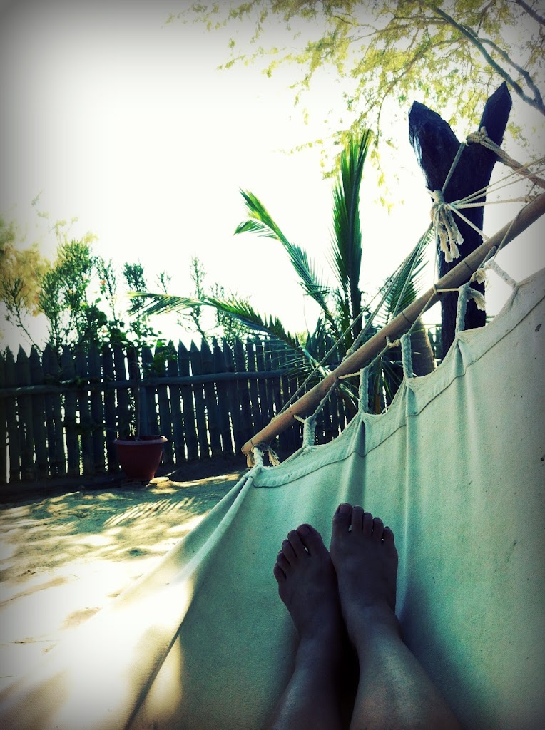
So, this was yet another adventure that overall, went as well as we could expect. Not knowing what to expect next all along the way is mentally exhausting, but we remained positive the whole trip. We won't go out on a limb and say we enjoyed it, but we gained more confidence and we would do it all over again.
Subscribe to:
Posts (Atom)